
Reviewed · VOLCANO HIKES FROM MEXICO CITY
Private Hike next to volcano at 14800 ft. from Mexico city
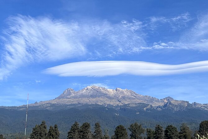
A rough dirt road, thin mountain air, and a trail climbing toward 14,800 feet make this much more than a casual day trip from Mexico City. You reach the high slopes of Iztaccihuatl-Popocatepetl National Park, then walk beside Mexico’s famous active volcano, Popocatepetl, with wide views toward Toluca and La Malinche when the sky is clear.
I like two things right away: the private format, which lets you walk at your own pace, and the high starting point at La Joya, so you spend your energy hiking rather than gaining every meter from the valley. The main caution is simple: this is a demanding altitude hike, and the long drive, traffic, dirt road, and weather can make the 10-hour estimate run much longer.
Key points before you book
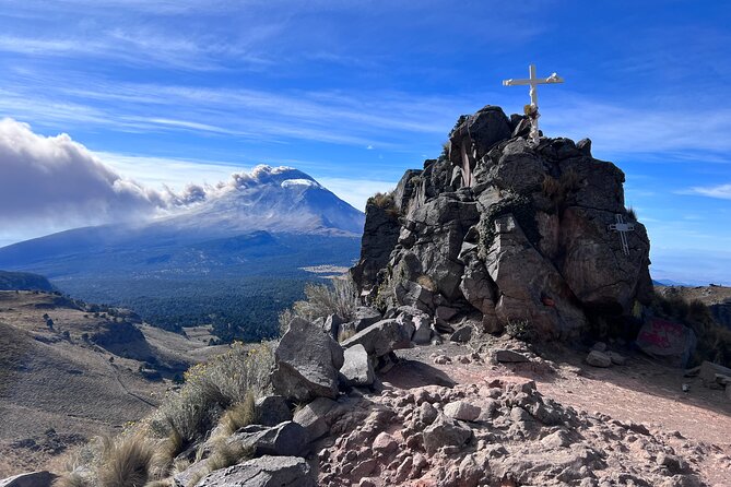
- The trail begins at about 4,000 meters, or roughly 13,100 feet, at La Joya.
- The planned ascent reaches about 4,524 meters, close to 14,800 feet, with three uphill stops.
- Private pacing is a major advantage, especially if you do not want to keep up with a larger group.
- Popocatepetl views are the main reward, with Toluca and La Malinche possible on a clear day.
- The return drive can take hours, particularly when Mexico City traffic is heavy.
- Bring serious mountain clothing and enough water, since the guides lend trekking poles but equipment support is limited.
Why this high-altitude day trip is special
Mexico City sits high above sea level, but this hike takes you far higher. You leave the city at 7 a.m. and drive for about two and a half hours toward Paso de Cortés, the mountain pass connected with the two great volcanoes, Iztaccihuatl and Popocatepetl.
The attraction is not a summit climb. You are walking on the lower and middle slopes near the volcano, with a planned endpoint around 4,524 meters. That makes the trip more accessible than a full mountain ascent, but it does not make it easy. At this height, a moderate slope can feel like hard work.
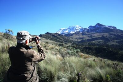
I like the sense of scale here. You are not simply looking at a volcano from a city viewpoint. You are moving through the high park toward it, stopping to catch your breath and take photographs as the view opens. On a clear day, you may also see Nevado de Toluca and La Malinche, Mexico’s fourth and fifth highest mountains.
This is a good match for you if you want a serious mountain outing without arranging camping, technical equipment, or several days away from Mexico City. It is less suitable if you want a relaxed sightseeing day with plenty of time in the city.
More volcano hikes out of Mexico City:
- Nevado De Toluca: Reach the Summit with Professionals
★ 4.8 · 250 reviews - Iztaccihuatl Volcano Hike with an Alpinist
★ 4.0 · 244 reviews - Mexico City: Guided Volcano Trek with Lunch
★ 4.7 · 242 reviews
The early pickup and the long road to Paso de Cortés
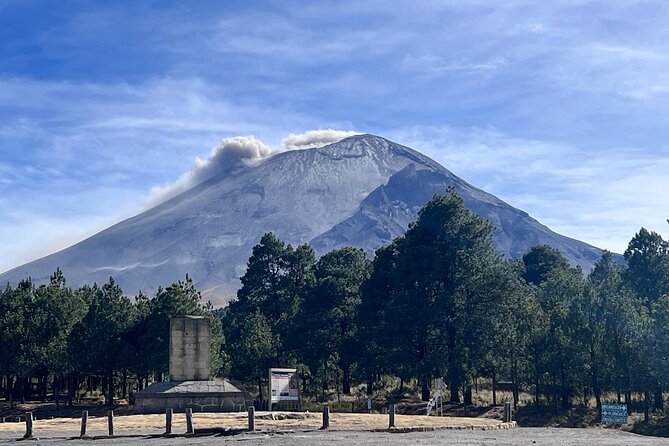
Pickup is scheduled for 7 a.m. at your accommodation in Mexico City. The route from areas such as Polanco can take about two hours and 40 minutes in normal conditions, though the return may be longer because afternoon traffic can be severe.
That timing matters. The hike itself is only one part of the day. You may spend close to five hours in the vehicle, and a serious traffic jam can stretch the full outing well beyond the advertised 10 hours. I would avoid scheduling an evening reservation or airport transfer after this trip.
The drive is included in the price, which makes the $174 per person cost easier to understand. You are paying for private transport, a private guide, park entry, a full day away from the city, and the convenience of having the mountain access handled for you. It is not a cheap short walk, but arranging a private high-altitude outing independently would require transport, park registration, route planning, and local mountain access.
The main transport weakness is that the agency does not currently use all-terrain vehicles. The final road to the trailhead is unpaved and rough, with sharp rocks. A tire problem has occurred on this road, so you should expect a basic vehicle and an imperfect ride rather than a polished mountain shuttle.
Paso de Cortés at 3,700 meters
Paso de Cortés is the entrance point for Iztaccihuatl-Popocatepetl National Park. At about 3,700 meters, you are already higher than many visitors expect to reach on a day trip from Mexico City.
Here, the group registers, receives entrance bracelets, and takes a short break for photographs. The stop lasts about 30 minutes. It is a useful pause before the rougher road and the walk, giving you a chance to check your layers, water, snacks, and camera.
Do not treat this as a casual administrative stop. Your body is already dealing with thinner air, and the hike begins at an even higher elevation. Eat something small, drink water, and tell the guide if you feel unwell before continuing.
The rough road to La Joya
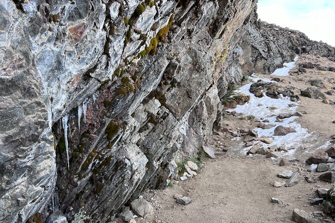
From Paso de Cortés, the vehicle continues about seven kilometers along a dirt road to La Joya, the trailhead parking area. La Joya sits around 4,000 meters above sea level.
This road is part of the adventure, but it is also one of the least comfortable parts of the day. Sharp rocks can damage tires, and the ride may be slow. If you have back problems or dislike rough roads, this is worth considering before you reserve.
At La Joya, the guide checks that you have enough water and food. Trekking poles are provided, which can help on the steep ascent and reduce stress on your knees during the descent. Still, I would bring sturdy footwear and your own well-fitting clothing rather than rely on the guide’s equipment.
The guide’s gear may be basic. One account described a guide using ordinary sports shoes, jeans, a cotton sweater, one trekking stick, and a small bag with only a 500-milliliter bottle. That does not automatically make the route unsafe, but it is a useful warning: this is a local guiding service, not a high-altitude expedition company with a full equipment system.
More Hiking and Trekking in Mexico City:
- From Mexico City: Hike Iztaccihuatl Volcano with an Alpinist
★ 4.3 · 155 reviews - Trekking Through The Volcanoes
★ 5.0 · 96 reviews - Hike at Nevado de Toluca Volcano
★ 5.0 · 69 reviews - 3 Hour Private Hike: Mountain Nevado Toluca from Mexico City
★ 5.0 · 59 reviews
Four hours on the upper mountain
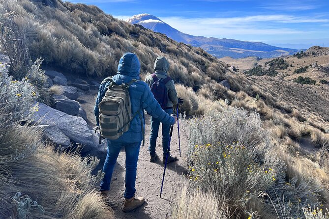
The hiking section is listed at about four hours, covering five kilometers in total. The route climbs steadily from La Joya, with planned stops at approximately 4,240 meters, 4,370 meters, and 4,524 meters.
The numbers tell you what kind of day this is. Five kilometers sounds short on paper, but at this altitude and on an uphill trail, it can feel like a long mountain day. You should expect a slow pace, frequent breathing breaks, and a noticeable difference between the lower and higher sections.
The private arrangement helps here. Guide Ruben has been praised for allowing a natural pace rather than pushing everyone to match a fixed group speed. If you are strong and acclimatized, you may move faster. If the thin air affects you, the guide can adjust the rhythm more easily than a large group usually can.
The route includes three main uphill stopping points. These are practical places to recover, eat snacks, and take photographs. The trail is not presented as technical climbing, but the steep altitude gain makes it physically demanding. Moderate fitness is the official standard, though I would interpret that as the ability to hike uphill for several hours in cold, thin air.
Carry enough water for the full walk. The information provided does not give a precise water amount, so do not assume the guide will supply it. A 500-milliliter bottle is not enough for a four-hour high-altitude hike. Bring your own supply and snacks, and keep food easy to reach while walking.
Popocatepetl views and changing weather
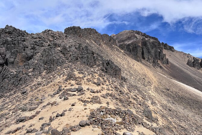
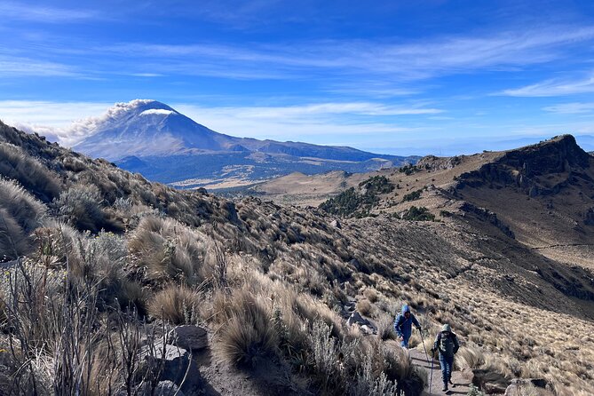
The central reward is the view toward Popocatepetl, one of Mexico’s best-known active volcanoes. The route places you near the volcano rather than at a distant city viewpoint, so your photographs should have a stronger sense of scale.
Weather controls how much you see. Clear skies can reveal Nevado de Toluca and La Malinche, but cloud, wind, or mountain haze may block distant peaks. You should book this for the mountain setting and the physical challenge, not for a guaranteed postcard view.
Dress in layers. The information does not provide a detailed gear list, but the elevation alone makes warm, weather-resistant clothing sensible. Wear proper hiking boots or similarly sturdy footwear. Gloves, a hat, and a waterproof outer layer are practical choices for a high mountain, though exact conditions vary.
The guide lends trekking poles, but you may prefer to bring your own if you use them regularly. Good boots, two liters of water, weatherproof clothing, a hiking backpack, and two poles were used successfully by one well-prepared participant. That is a useful standard for your own packing.
The descent is easier, but not effortless
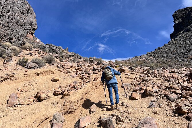
After the high point, you return by the same route to the vehicle. The descent may feel faster, but loose or uneven ground can be tiring, especially after several hours at altitude.
The private format remains useful on the way down. You can stop for photographs or take a slower pace without holding up a larger party. The guide should also monitor how you are doing, though you remain responsible for telling the guide about dizziness, unusual fatigue, headache, or other altitude symptoms.
Lunch and snacks are taken during the mountain portion. This is convenient, but do not expect a restaurant meal or a long picnic service. Pack food you can eat quickly during a break. The schedule is built around walking, not lingering.
What can go wrong with timing
The official duration is about 10 hours, but that number is best treated as an estimate. The outbound drive can take roughly two and a half to three hours. The hike takes about four hours, and the return to Mexico City can exceed four hours in heavy traffic.
One trip became much longer after road closures linked to a fatal accident, traffic jams, and a flat tire on the rough road. These events are not normal parts of every departure, but they show how little spare time you may have on this route.
The provider has also acknowledged that guides are local mountain enthusiasts rather than high-altitude professionals. That distinction matters. You are booking a local private outing, not a mountaineering course led by an expedition specialist.
There is also some uncertainty around the exact endpoint. The main route description gives three stops, ending at about 4,524 meters. A provider response refers to a third gate at 5,420 meters, which conflicts with the advertised elevation and would be a much higher point. Confirm the intended maximum height before booking, especially if the exact altitude is important to you.
Private service and the value of the price
At $174 per person, this costs more than a large-group volcano excursion. The extra money buys privacy and flexibility, not luxury.
That flexibility is the strongest part of the deal. You can walk at your own speed, stop for photographs, and avoid being limited by the slowest person in a shared group. If you are traveling with a fit companion and want a more personal mountain day, the price can make sense.
There are limits. If one person in your party becomes sick, the published terms do not provide a refund for the unused place. A two-person booking can therefore become expensive if only one person continues.
The tour is offered in English, and confirmation is sent at booking. Group discounts are available, which may improve the value for a larger private party. Free cancellation is available until 24 hours before the start time. Changes or cancellations inside that window are not refunded.
Who should book this hike?
I would recommend it to you if you:
- Want a private volcano outing from Mexico City
- Are comfortable hiking uphill for about four hours
- Have some experience with high-altitude walking
- Prefer a flexible pace and private guide
- Can handle a long day in a basic vehicle
- Care more about mountain access than polished transport
I would be cautious if you:
- Have not done strenuous walking before
- Are sensitive to altitude
- Need a strict return time
- Expect professional expedition equipment
- Dislike rough roads or long traffic delays
- Want a gentle nature walk
The guide and vehicle setup are the key areas to assess honestly. The route itself offers a strong mountain setting, but the service is practical and local rather than premium.
Should you book the Iztaccihuatl volcano hike?
Book it if your priority is a private, high-altitude walk with direct volcano views and you accept a long, unpredictable day. The ability to walk at your own pace is a real advantage, and the route reaches a remarkable elevation without requiring a summit expedition.
Before paying, confirm the exact endpoint, ask about the vehicle, and make sure the guide will follow the planned route to the advertised elevation. Bring enough water, proper footwear, warm layers, snacks, and a free evening after the tour.
I would choose this trip for a strong walker who wants an unusual day outside Mexico City and understands that mountain access can be rough around the edges. I would skip it for a relaxed sightseeing day or for anyone who needs dependable timing.
FAQ
What time does the tour begin?
Pickup begins at 7 a.m. from your accommodation in Mexico City.
How long does the tour last?
The stated duration is about 10 hours, though traffic, road conditions, weather, and unexpected delays can make the day longer.
Where does the hike begin?
The hike begins at La Joya in Iztaccihuatl-Popocatepetl National Park, at about 4,000 meters above sea level.
How far do you hike?
The total hiking distance is about five kilometers, including the ascent and return.
What altitude does the hike reach?
The planned route includes stops at approximately 4,240 meters, 4,370 meters, and 4,524 meters. Confirm the exact endpoint before booking because another provider response gives a different third-gate elevation.
Are trekking poles provided?
Yes. Trekking sticks are lent to participants for the hike.
Is this a private tour?
Yes. Only your group participates in the private activity.
Can you cancel for a full refund?
Yes, if you cancel at least 24 hours before the experience start time. Cancellations or changes made less than 24 hours in advance are not refunded.
Just added around Mexico City
- Xochimilco’s Wild Side: Mezcal, Insects & Culture★ 4.9 · 10 reviews
- Xochimilco: Food and Trajinera Ride with Local Women★ 5.0 · 5 reviews
- Xochimilco: Island of the Dolls Tour Games and Drinks★ 5.0 · 25 reviews
- Xochimilco Ecological Tour – Away From the Crowds (3 Hours)★ 5.0 · 15 reviews
- Xochimilco + Coyoacán Combo Full-Day Tour★ 5.0 · 3 reviews
- Xochimilco floating gardens, Coyoacan and UNAM murals★ 4.0 · 6 reviews
- Val´quirico And The City of Angels Puebla From Mexico City★ 5.0 · 3 reviews
- Xochimilco: amanecer en kayak Ciudad de México★ 5.0 · 35 reviews
Volcano Hikes from Mexico City, compared.
Nevado De Toluca: Reach the Summit with Professionals
Read our review →
2 Volcanos – Special 2 pax, 3 -4 hr ride. Reserve Only 1 pax
Read our review →
Mountaineering to the Nevado de Toluca (altitude 4680m)
Read our review →
Browse the lists this tour appears in